| « | Googling around Scotland |
» |
I have Google Latitude enabled in my phone, mainly so that Beth knows where I am, and periodically they email me and this time I actually paid attention when they said about having recorded where I'd been and wondered what they made of our trip to Scotland so I asked and here's the result:
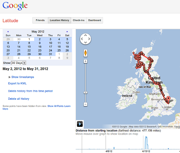
It's pretty impressive until you look at the north west corner. Bear in mind that for geolocation unless you have your GPS on (unlikely unless you've got external power as it canes the battery) or you're in a urban area where the phone can sniff WAPs for their SSIDs they're relying on looking at which mobile phone mast your phone is talking to.
So we ended up with this:
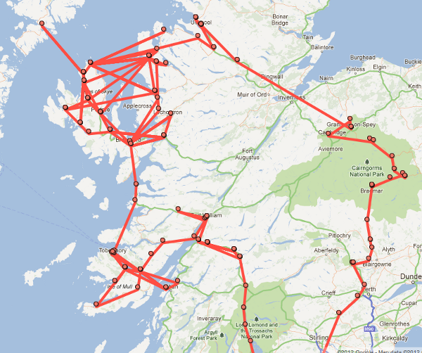
As you can see we apparently crossed from the mainland to Skye and back again rather a lot of times (rather than once), and we also seem to have managed a trip down the Sound of Mull to Oban, but my favourite of all is where we succeed in crossing the Inner Minch to Harris for a few minutes.
All of which illustrates the weakness to the technique: it works well when the masts are only covering a fairly small area, but in the highlands a mast can cover a big area, especially a mast on a hill near the coast where it may also be covering land on another island.
Still pretty neat though.
| Tags: internet, maps | Written 17/06/12 |
| « | » |

